Devarayanadurga near Bangalore
Here is another addition to the long list of weekend getaways from Bangalore.
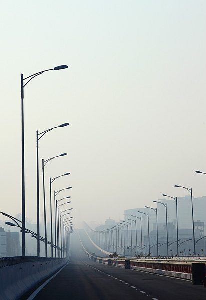
We drove through some of the finest roads in the neighbourhood as the darkness made way for the first light of the dawn, on a not-so-chill winter morning last week. The obstacle-free NICE road and the toll highway to Tumkur let us clock the miles quickly and approach our destination earlier than expected.
The sun came out in his orange winter glow a little later than 6.30, when the air was still not warm and the body was still sleepy. I took shelter in the warmth of the car cabin and refused to join my fellow travellers—Srinidhi, Ravi and Santosh—in the rush to photographing the sun before his hues disappeared.
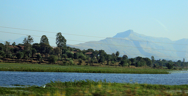
Further ahead, in Uradigere village just before the turn to our destination Devarayanadurga, a restaurateur had just started work on his grinding machine and could offer us nothing more than a cup of coffee. The road climbed up soon after, taking us through a forest surprisingly thick and beautiful for this terrain. The road meandered past a large rocky slope and a lake with its calm surface before arriving at Durgadahalli Village, above which was our destination.
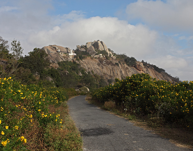
The approach to Devarayanadurga
Standing on the top of Devarayanadurga, nothing blocked my views all the way to the horizon as I looked at the villages on the plains to the east. The northern side of my view had a range of hills that tapered away gently into the plains. Lakes of various sizes glittered in the early morning sun all along the plains, standing out amidst the thin winter fog that hid the details of the landscapes. To the south, a sharp rocky peak jutted out in the hazy weather as the sun rays filtered through the fog and selectively brightened its half-dome-like peak, which attracted my eye with its unusually sharp summit pointing towards the sky.
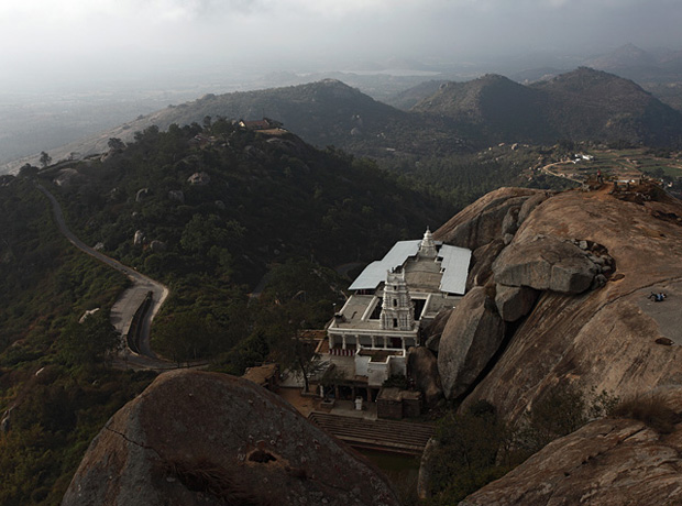
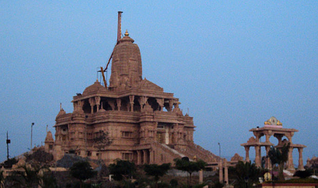
Lakshmi Narasimha Swamy Temple at Devarayanadurga
As one would expect to see anywhere on a high post all along the religious India, a temple stood below the peak of Devarayanadurga too, built on a narrow space just wide enough to accommodate its building. Wikipedia mentions of a history to the region that dates back to the Hoysala Kings and later to Vijayanagar empire, though the temple in its current form is attributed to the Wodeyars of Mysore. The sign at the temple indicated that the they open at 10am, but in the month preceding Sankranti, activity begins as early as 6am.
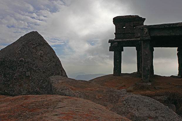
I sat on the rocky peak and let the strong breeze flow into me as I watched the world below appearing and disappearing with the drifting fog. As the day progressed and the sun gained strength, our stomach grumbled and complained of the missed breakfast, prompting us to head back to Uradigere.
Refulling with Thatte Idli served with a spicy chutney, we moved further to Namada Chilume, a sanctuary for deer in a vegetation surprisingly rich in this otherwise open terrain. Namada Chilume gets its name from a small perennial spring that trickles from a rock. The story goes that the spring was formed when Lord Rama in need of water shot an arrow into the rock. He needed drops of water to smear a nāma on his forehead, and hence the name Namada Chilume. In the adjacent sanctuary is a small fenced area that houses a group of spotted deer. A rocky aberration nearby hosts an ancient looking mantapa on a series of pillars, surrounded by thick vegetation that has begun shedding leaves for the winter. The surrounding hills and the nearby trees have a range of colours varying from green to yellow to a dark red, making up the best display of fall colours that you can see in the tropics.
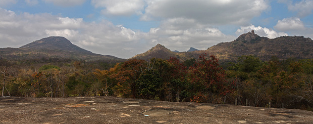
The vista from a rock near Namada Chilume
We proceeded further from Namada Chilume, circumventing Devarayanadurga whose tall peak stayed in our vision for most of our way. We had impulsively decided on our next destination as Madhugiri Fort, which had some surprises to offer us. More about Madhugiri Fort in another post.
Information
Devarayanadurga is a hill located approximately 90km from Bangalore. It can be easily done as a day-trip combined with a some of the other places nearby like Namada Chilume and Madhugiri Fort. The Lakshmi Narasimha Temple on the hill seems to be a popular place.
There are no restaurants at Devarayanadurga. If you are likely to be there at lunch time or planning to spend a lot of time, it is best to carry some food. A shop near the temple sells tender coconut, water bottles and some packaged foods like biscuits. About 15-minutes drive from Devarayanadurga is Uradigere village where you can get some basic food in small restaurants. There is no accommodation at the hill except for a forest department rest house. They might rent out the rooms, but it is recommended to check before you go.
There are two ways to get to Devarayanadurga. Head out on NH4 (Tumkur Road) from the city. After you drive for approximately 20km from the toll gate at Nelamangala, you will see a flyover at a place called Dobbspet. Go under the flyover and turn right and take the road leading to Devarayanadurga. There are no obvious signs indicating the arrival of Dobbspet or to provide directions to Devarayanadurga, so your best bet is to lookout for the flyover. After about 15km of driving, you will come to a junction in a village called Uradigere. Continue past Uradigere for about 250m where you see a left turn. Turn here and drive for another 15 minutes to reach Devarayanadurga.
Alternately, continue on NH4 till you exit through the toll gate near Tumkur. You need to turn right a little ahead (see map) and drive for another 20 minutes to reach Devarayanadurga. This road takes you through Namada Chilume.
Namada Chilume is a 10-minute drive from Devarayanadurga.
Below is the map and driving direction from Bangalore to Devarayanadurga
View Bangalore to Devarayanadurga in a larger mapView Bangalore to Devarayanadurga in a larger map
